
Sale!

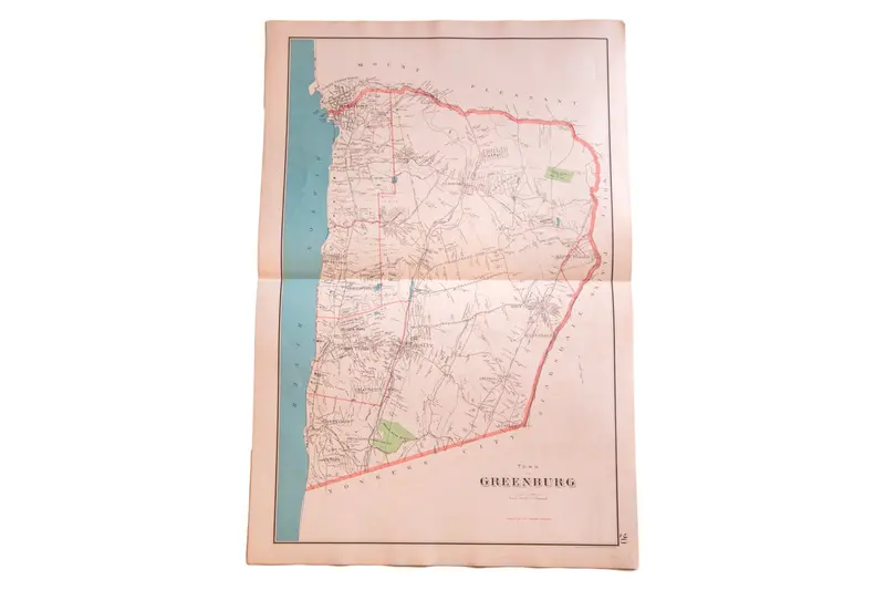
Antique Greenburgh NY Map

$195.00 $146.25

SKU: 3363 Category:

📍 -- people have viewed this product recently

🚚 Estimated Delivery: Nov 03 - Nov 08

📦 Shipping Policy: Free on orders over $30

🛡️ 30-Day Returns: Free return shipping, no restocking fees

✉️ Customer Support: Dedicated 24/7 assistance

🔒 Guaranteed Safe Checkout

Guaranteed Safe Checkout

:: Antique map of Greenburgh (at the time named Greenburg), of Westchester County New York. The map shows the Hudson River and a large encircled area that includes towns such as Irvington, Dobbs Ferry, and Ardsley. Surrounding areas are marked by name only, and include White Plains, Mount Pleasant, Yonkers City, and Scarsdale. Published by Julius Bien, circa 1893. Measures 20.5″x30.5″.

Item ID: 3363
Title

Default

Reviews

There are no reviews yet.

Be the first to review “Antique Greenburgh NY Map”

Your email address will not be published. Required fields are marked *

Shopping Cart
Scroll to Top